Three of the guides ranking for this question recommend Playa Delfines as a beach with less sargassum. In March, Cancun’s crews hauled 269 tonnes off the sand, particularly at Playa Delfines. Somebody is copying somebody, and nobody is checking the map.
The short answer
Sargassum in Cancun runs roughly March to October and peaks May through August. November to February is reliably the clearest. Which way a beach faces matters more than which resort is on it: the current runs east to west, so east-facing beaches take the hit and north-facing ones stay clear.
We book boats on this coast every week of the season, including the bad weeks, so we spend a lot of time telling people the water is fine and the beach is the problem. Everything below is measured, sourced and linked, and where the numbers disagree we say so.
The 2026 season, as actually measured
Most articles give you a season in vague months. The University of South Florida measures the whole Atlantic by satellite every month and publishes the tonnage, so here is the real curve rather than somebody’s memory of last summer.
| Month, 2026 | Whole Atlantic belt | Western Caribbean, the bit that lands on you | What that meant |
|---|---|---|---|
| January | 9.5 million tonnes | Not separately resolved | A record January, with some beaching already |
| February | 13.6 million tonnes | Not separately resolved | Building |
| March | 19.1 million tonnes | Not separately resolved | Major beaching on the Mexican Caribbean coast |
| April | 28.7 million tonnes | 4.0 million tonnes | The bad stretch starts |
| May | 28.9 million tonnes | 3.5 million tonnes | Plateau, not a spike |
| June | 33.6 million tonnes | 3.6 million tonnes | The peak of the year |
| July | 25.5 million tonnes | 3.5 million tonnes | Belt falling, your coast unchanged |
| August | 12.5 million tonnes | 1.7 million tonnes | Halved. The season breaking. |
Two things worth taking from that table. The western Caribbean does not spike, it plateaus from April through July and then drops off a cliff in August. And the belt total peaks in June, which is also when it peaked for everybody from Africa to the Gulf.
One correction, because it is everywhere. 2026 was not the record year. 2025 was. USF walked its own forecast back through the season, from “likely to be a record year” in March to “the second largest Sargassum year, only second to 2025” by the end of July. The Gulf of Mexico did set records, nearly doubling its 2025 high in June. The year as a whole did not. Both things are true and travel articles keep picking the wrong one.
The rule nobody gives you: which way does the beach face?
Here is the whole mechanism in one sentence. Sargassum arrives on the North Equatorial and Caribbean currents, both running east to west, so it hits east-facing shorelines head on and mostly skips anything tucked behind a headland or facing north.
That is it. That is the rule. Every guide hands you a list of beaches; none hands you the compass, which is a shame, because the compass still works on a beach nobody wrote an article about.
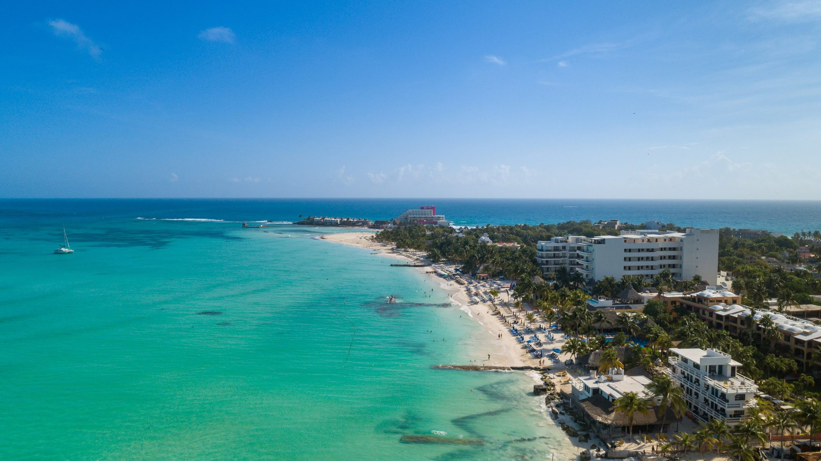
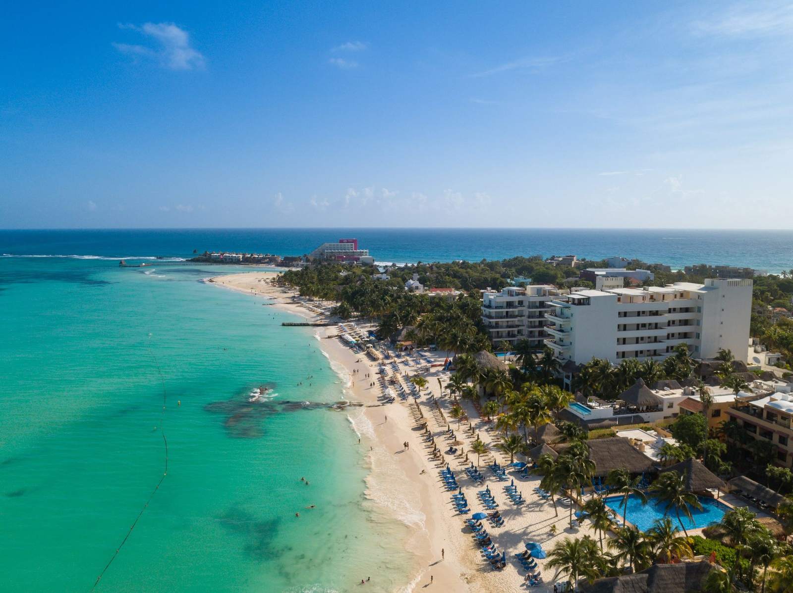
Cancun’s hotel zone is shaped like the number seven. The short arm at the top faces north into the Bahia de Mujeres and sits in the shelter. The long arm down the side faces the open Caribbean and takes everything the current is carrying. Same city, same week, two completely different holidays, and the difference is a corner.
| Beach | Which way it faces | How it actually reads on the official map |
|---|---|---|
| Playa Las Perlas, Linda, Langosta, Tortugas, Caracol | North, into the sheltered bay | Reported at low levels through the 2026 season |
| Punta Cancun and Playa Gaviota Azul | The corner, where it turns | Mixed, and it swings with the wind |
| Chac-Mool, Playa Marlin, Playa Ballenas, Playa Delfines | East, straight at the open Caribbean | Flagged red for excessive arrival |
| Playa Norte, Isla Mujeres | North-northwest, behind the island | Clear on the official reading of 5 June 2026, mid-season |
| Cozumel west coast | West, with the whole island as a shield | Minimal, some spots unchanged for two to three months |
| Holbox | North, and on the Gulf side entirely | Minimal across all its beaches |
| Tulum | East and fully exposed, no reef shelf | Playa Ruinas excessive, the rest moderate with no improvement |
The beaches the guides get wrong
This is the part that made us write the article.
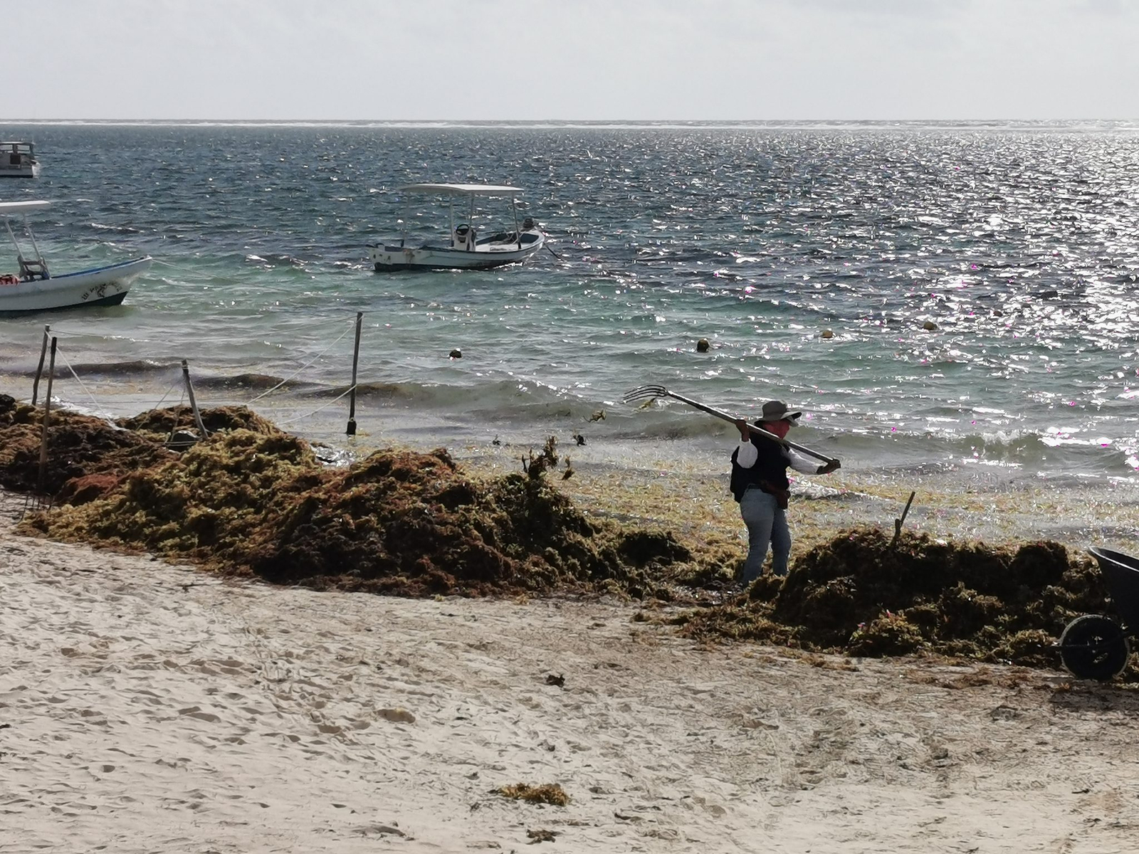
A page that currently ranks for how to avoid sargassum in Cancun names Playa Delfines, Playa Marlin and Playa Ballenas as beaches with less sargassum. All three sit on the exposed eastern arm. All three have been flagged red by the state’s monitoring network. And in March 2026 Cancun’s municipal crews removed 269 tonnes of it, particularly at Playa Delfines.
We are not picking on one blog. That list has been copied across the internet for years, because Playa Delfines is the famous one with the sign, and famous is easier to write than checked. It is also the most exposed stretch in the hotel zone, which is precisely why it has the biggest waves and the best photographs.
The lesson is not “avoid Delfines”. It is that a beach list written in 2019 and recopied ever since is worth less than one look at the map that gets updated today.
Where it genuinely stays clear
Four places hold up when you check them against the official readings rather than against each other.
Playa Norte on Isla Mujeres. It sits at the northern tip, facing north-northwest across the bay, with the entire island between it and the incoming current. It came back clear on the official reading of 5 June 2026, which is about as mid-season as mid-season gets. Not immune: a January surge put roughly 220 tonnes on the island’s beaches and crews cleared it the same day. The honest claim is consistently the best in the region, not sargassum-free.
The west coast of Cozumel. The island takes the hit on its eastern side and the western shore sits in the lee. Palancar, El Cielo and Playa Uvas were all reading minimal in June, some with no meaningful change in two to three months. Cozumel is the most reliable snorkelling on this coast in a bad seaweed year, and it is not close.
Holbox. It is on the north coast of the peninsula, in the Gulf, not on the Caribbean-facing side at all. Different water, different problem, which in this case is no problem.
The entire Pacific coast of Mexico. Sargassum is an Atlantic system. There is no current that carries it around into the Pacific, so Cabo San Lucas, La Paz and Puerto Vallarta get none of it. Not less. None, ever, in any month. If your dates are locked to July and your heart is set on a clean beach, that is the answer nobody in Cancun is going to give you.
What is actually in the water, and what is just unpleasant
Straight answers, because this is the section where travel writing usually goes either irresponsibly breezy or wildly overcooked.
The smell is a 48-hour clock. Sargassum starts decomposing roughly two days after it lands, and that is when it releases hydrogen sulphide, which is the rotten-egg smell, plus ammonia. Fresh sargassum is ugly. Two-day-old sargassum is the problem. Which is why a resort that rakes at six every morning and the one next door that does it on Thursdays are, functionally, different hotels.
Sea lice are not lice. They are the larvae of the thimble jellyfish, each about the size of a speck of ground pepper. They ride the mats in through the surf line, get caught under a swimsuit, and the friction sets off their stingers. You get an itchy rash under exactly the parts of you that were covered, which is a genuinely unfair way to be stung.
The health research is about workers, not tourists, and the difference matters. A 2026 study of shoreline cleanup crews found 46 percent of hydrogen sulphide readings exceeded Mexico’s occupational limit of 1 part per million over an eight-hour shift. That is people standing in decomposing seaweed all day with a rake. Walking past it on the way to lunch is not the same exposure and we are not going to pretend it is.
Where it does matter: if anyone in your group has asthma or a chronic respiratory condition, a beachfront room over an uncleaned stretch in July is a bad booking. That is a real consideration, not a scare.
What is being done about it
More than you would guess from the beach, and still not enough to keep up.
The Mexican Navy has run the operation since 2019 and it is not a token effort: eleven coastal sargassum vessels, an oceanic one, two amphibious ones, eighteen support craft and 191 sailors in permanent beach teams. Over 13,000 metres of barriers were deployed by September 2026, up from about 7,600 in May. Collection capacity runs around 627 tonnes a day, rising to about 1,227 once a new vessel enters service.
Quintana Roo had collected 123,400 tonnes by 8 September 2026. The whole of 2025 was around 93,000. In July, the federal government announced an integrated strategy funded at 2,635.6 million pesos, with the strategy deliberately shifting toward catching sargassum at sea before it reaches sand.
And the thing that contradicts most of the advice online. Floating barriers are not allowed in Cancun’s hotel zone at all. The municipality ruled them out after technical studies found the wave action there simply washes sargassum over the top of the nets. The first working barrier in the municipality went into the sheltered Playa del Nino in July 2026. So the standard tip, pick a hotel with a barrier, does not apply in the one place most people are booking.
The scale problem is the honest conclusion. The upgraded fleet handles a bit over a thousand tonnes a day. Reported peak arrivals across the state run several times that. The Navy is bailing out a boat that is still taking water, quite well, with a fairly good bucket.
The number that explains why the boat works
Every USF bulletin defines its own colour scale in the same sentence, and it is the most useful line in the entire literature: the top colour, red, means 0.4 percent of the ocean surface is covered, with clumps and mats scattered here and there.
Read that twice. The reddest square on the satellite map, at the peak of the second-worst year ever recorded, means 99.6 percent of that water is open sea. Scattered clumps. Not a carpet.
So why does the beach look like that? Because the beach concentrates it. Wind and current push mats onshore and the sand has nowhere to put them, so a thin scatter over many square kilometres becomes a metre-deep windrow along a few hundred metres of shoreline. Only 5 to 10 percent of the sargassum sitting near the coast ever lands at all. You are looking at the small fraction that did, piled up.
Which is the whole argument for getting off the sand, and we should be honest about its limits too. Open water is not magic. You can absolutely meet floating rafts on a crossing in a bad week, because the satellite maps are literally maps of sargassum in open water. They are patches you steer around rather than a wall. And a strong onshore easterly can move offshore material inshore within hours.
The real product is not “open water” as an idea. It is specific places that geography protects: the crossing to Isla Mujeres and the sandbar on its sheltered side, the reefs off Cozumel’s west coast, the lee of the island. Those are the same places the official readings come back clear, which is not a coincidence.
How to check before you go, and on the day
Three sources, in order of how much you should trust them for an actual beach on an actual morning.
- The Red de Monitoreo del Sargazo de Quintana Roo posts a near-daily colour map of the state’s beaches. This is the authoritative daily source and it is a Facebook page, which is not where you expected this paragraph to go.
- sargazo.info is the same network’s website, beach by beach, if Facebook is not your thing.
- The USF Sargassum Watch System for the month ahead and the big picture. Not for your beach on Tuesday, and USF says so itself: its bulletin should by no means be used to predict conditions at a specific location.
The timing rule that matters: the colour map is dynamic and a beach can change overnight on a shift in wind. Check it the day you are going, not the week you are booking. Checking in March for a July trip tells you about March.
On refunds, the honest position is that there is no industry-standard sargassum policy and no major chain publishes one. What works is structural: book a refundable rate, look at the conditions two or three weeks out while you can still move, and remember that hotels on this coast were discounting hard through the 2026 season. Occupancy in Tulum fell to 15 percent and Playa del Carmen to 30. That is bargaining room, and it is the only silver lining in this entire article.
What we see when people book
Four things, every single season.
People cancel the trip when they should move the day. A bad sargassum week is not a bad week in Quintana Roo. It is a bad week on about forty kilometres of east-facing sand. The cenotes, the ruins, Isla Mujeres and the reef are all having a completely normal time.
People pick the hotel and never look at the compass. Two resorts four kilometres apart, one on the north arm and one on the east arm, are a different holiday in July. That is a free decision and almost nobody makes it deliberately.
People book the boat as a nice extra and then it becomes the trip. In a heavy week, the day on the water is not a treat on top of the beach holiday. It is the beach holiday. Groups who worked that out in advance had a much better week than groups who worked it out on Wednesday.
People assume the whole Mexican Caribbean is equally affected. In the middle of August the state’s south had thirty beaches on red alert against two clear, while the north had forty-five green and three clear alongside its twenty-two red. Same state, same day. Where you are matters as much as when you are.
Common questions
When is sargassum season in Cancun?
Roughly March to October, peaking May through August, with June the heaviest month in 2026. November to February is reliably the clearest stretch of the year.
Which Cancun beaches have the least sargassum?
The north-facing beaches on the short arm of the hotel zone: Las Perlas, Linda, Langosta, Tortugas and Caracol. The east-facing beaches further down, including Delfines, Marlin and Ballenas, are the most exposed despite what several guides say.
Is it safe to swim in sargassum?
The seaweed itself is not toxic to touch. The real issues are thimble jellyfish larvae caught in the mats, which cause an itchy rash, hidden debris, and the hydrogen sulphide released once it has been rotting for about two days on the sand.
Does Cabo San Lucas get sargassum?
No. Sargassum is an Atlantic phenomenon and there is no current that carries it into the Pacific. Cabo San Lucas, La Paz and Puerto Vallarta are unaffected in every month of the year.
Is there sargassum in the water if I go out on a boat?
Usually very little. At its worst on the satellite maps, sargassum covers about 0.4 percent of the sea surface as scattered clumps. It is the shoreline that concentrates it into what you see on the beach. You can still meet floating rafts on a crossing in a heavy week.
Was 2026 the worst sargassum year on record?
No. 2025 holds the record and 2026 came second overall, though the Gulf of Mexico did set new records in June and July. Quintana Roo collected more than 123,000 tonnes by early September 2026, against around 93,000 in all of 2025.
Book the water, not the sand
Tell us your dates and where you are staying. If your week lands in the heavy months we will say so plainly, and then we will put you on the water on the sheltered side, which is where the clear water has been the whole time.
And if your dates are locked to July, we will tell you about the other coast.


